International School History - International Baccalaureate - MYP History

MYP4 Last update - 28 novembre 2017  
Unit 2 - Lesson 2 - Outside Christendom - Medieval Maps

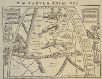
Münster’s map of the World


This double-page woodcut copy was published in the first edition of Sebastian Münster’s atlas, the Geographia Universalis, Vetus et Nova (Universal Geography, Old and New), in 1540. This is after both the Renaissance and Reformation. Münster was skilled in ancient languages, mathematics and cartography and sought to represent the work of Ptolemy in an accurate, newly translated edition.

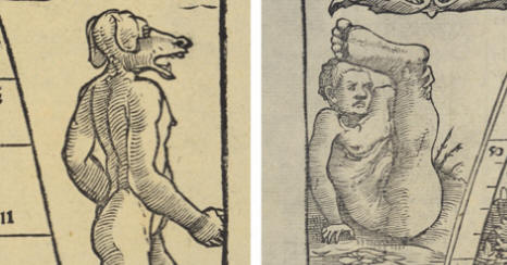
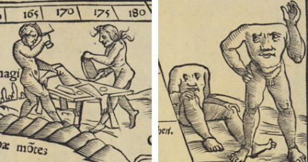
This map is decorated in the margins with images of Antipodean monsters, and is significant for its ability to demonstrate the survival of ancient conceptions about the world, including the existence of a monster-filled Great South Land.

These ideas remained current in the 16th century, until improved navigation and a greater reliance on empirical evidence began to challenge older beliefs.

 
Black and white map of India and Central Asia reproduced around 1540, 'Tabula Asiae VIII'
 

Woodcut map Tabula Asiae VIII by Sebastian Münster, Basel

   
Map details of monster images showing a human man'sbody with the head of a dog; and a seated man with one leg and a giant foot extended upwards. Map details of monster images showing two men cutting up body parts and headless men with faces on their torsos.
   
Activity

Neither the Hereford map nor Münster’s map are geographically nor ethnographically reliable. Explain what this means and also explain why although unreliable, both maps very useful to historians.


About I Contact Richard Jones-Nerzic